Now, you can visit any part of the world and explore that place in 3D from the comfort of your home. At present, the street view is available in around 50 countries worldwide. But, the numbers are increasing and the day is not too far when every country will have a Street View feature. But before that, if you don’t know what Street View is and how to use it then you can read this tutorial to get more insight on it.
What is Street View And How Does IT Work?
Google Street View is an exclusive technology that features in Google Earth and Google Maps.
1 What is Street View And How Does IT Work?2 Use Google Earth Street View2.1 Google Street View Vs Ground Level View2.2 Final Thoughts
It provides high-quality 3D panorama images of the streets around the globe. Now you must be wondering how is that possible? Well, Google has its cars running down the streets around the world with 360-degree cameras mounted at the top. These cameras record the streets in ultra HD quality and then these stills are uploaded to Google’s server. You can also capture a 360-degree image of your place and upload it to the server so that people can view your place in panorama mode. Now since you know what street view is let’s learn how to use it on Google Earth.
Use Google Earth Street View
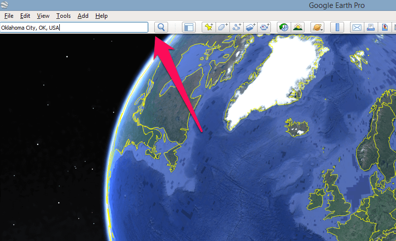
Launch the Google Earth Pro on your PC. If you don’t have it installed, download it first. And search for a location and zoom into the place of your interest with the help of the mouse wheel or the zoom-in zoom-out icons.
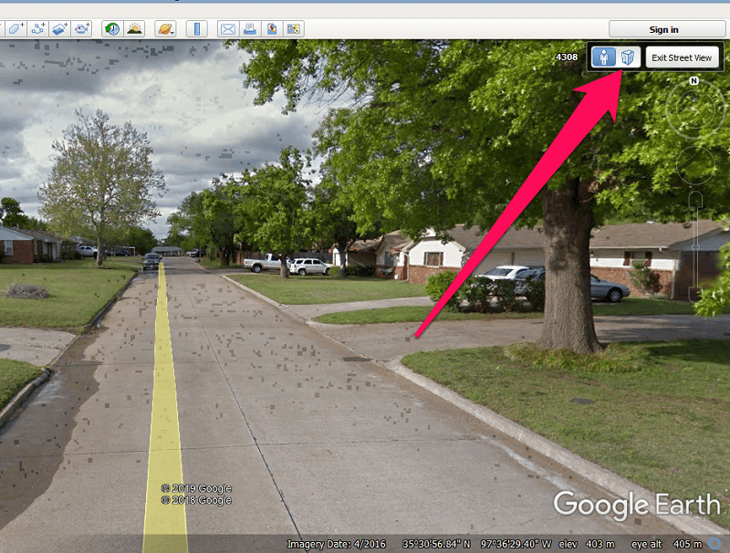
Now, select the Pegmen icon from the right side of the screen.
As you do that, some parts of the map will turn blue which means the street view is available at these places. Now drag and drop the Pegmen icon anywhere on the blue part of the map.
Now, the Street View will open and you can move to any desired place on the screen by double-clicking in that direction. Or you can use the mouse wheel to look around or to go forward or backwards in the street.
You can also switch between the street view mode and Ground-level view by clicking on the building icon on the top right corner.
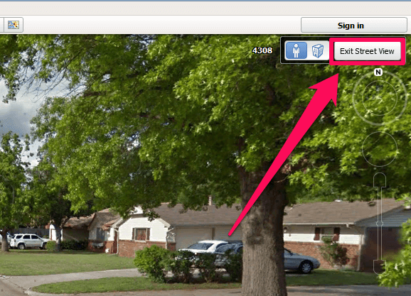
If you are done with street viewing you can simply log out of the street view mode by clicking on the Exit Street View button on the top right corner.
Google Street View Vs Ground Level View
The Ground level view as you may have seen on the Google Earth Pro is a feature that lets you see the satellite image of a particular place in 3D. Similar to the Street View mode, you can roam around any part of the world in 3D. You can use the arrow keys on the keyboard to move in any particular direction on the map. The good thing about the Ground level view is that unlike street view it is available in every part of the world i.e you can explore literally anything on the planet from the ground level view in 3D be it mountains, rivers, buildings, etc. However, the street view mode shows us better images than the Ground Level view because of the images that we see in the Ground level view are more animated and sketchy. While the images in the Street View mode are real and are captured in HD cameras mounted on Google taxis.
Final Thoughts
If you think you can not visit different countries in the world then you are totally wrong. Because with Google Earth’s Street View mode you can visit any part of the world and roam around the streets virtually from your home. If you liked our article then don’t forget to share it with your friends and family. Save my name, email, and website in this browser for the next time I comment. Notify me of follow-up comments via e-mail.
Δ
![]()